The FLAG covers the entire 130km coast of the Emilia-Romagna region. In this region fishing and lagoon fish farming have a tradition for centuries. The local economy is mainly based on fishing, aquaculture, mari-culture and summer coastal tourism.
Although the Region of Western Macedonia accounts for 60% of all of Greece’s water reserves, previous efforts at developing fisheries in the area have failed to gain traction.
The FLAG area of Pieria, which is found along the western shore of the Gulf of Thermaikos, is a rural area where fishing is an important economic activity. It is well known for shellfish farming and in 2014 it produced over 8 400 tons of mussels representing over 85% of overall Greek production for the year. In addition to aquaculture, sea fishing remains important here.
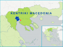
The FLAG area plays host to many important fisheries activities (including more than 60% of Greek mussel production). The main advantage the area has is its proximity to the large market of that the city of Thessaloniki offers. In general, however, fisheries here remain mostly small-scale.
The FLAG area stretches between two gulfs on the Macedonian coast. Its main advantage is its proximity to the big market town of Thessaloniki. The type of fisheries found here ranges from small to medium scale. The area has one fishery harbour with a fish auction, three fishery shelters, and significant processing infrastructure.
The area is very rural with thousands of years of history. There are many protected sites of natural beauty and the region attracts many tourists especially to the well-known island of Thassos. Fisheries in this area is mostly small-scale, complemented by some aquaculture and a limited amount large-scale fisheries activities.
Historically linked with the tobacco trade commerce as well as fish processing and retail, Kavala city is a beautiful amphitheatrical city open to Aegean Sea. The most important features of the area is the fisheries sector including small-scale and large-scale fishing.
The FLAG area comprises the lagoons of Vistonida, Ismarida, Porto Lagos, Aliki, Ptelea, Xirolimni and Karatza, parts of the Nestos and Kompsatos river basins and the coastline of Rodopi and Xanthi prefectures (up to 10 km inland).
The Santa Pola FLAG is located in the South East of the Iberian Peninsula and covers the municipalities of Santa Pola and Guardamar. The main economic activities in both localities are fishing, aquaculture and tourism; salt production in salt lakes is also quite relevant.
The Mariña-Ortegal FLAG is situated in northern Galicia covering 13 municipalities from two provinces. The area includes six estuaries and 16 ports, all of which have some level of fisheries activity. Ten of the ports have fish auctions, while four also have marinas.