FARNET
Fisheries Areas Network

Tourism

  • Parnu FLAG

    05/09/2017
    - FLAG Factsheet
    Located in the south-west of Estonia, the FLAG area is situated around the Pärnu Gulf. The largest of the Estonian counties, Pärnu geographically covers 10.6% of the Estonian mainland and a total of 177 islands; of which only two, Kihnu and Manija, are inhabited.
  • Lake Võrtsjärve FLAG

    05/09/2017
    - FLAG Factsheet
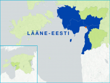
    Lake Võrtsjärv is the second largest lake in the Baltic countries and the largest lake in Estonia. The lake is covered with ice, on average, 130 days a year (from the end of November until mid-April). Total catches in the FLAG area have fallen in recent years which is a challenge. This is due, in large, to a decline in consumer demands for smaller bream
  • West Mecklenburg Baltic Sea coast FLAG

    01/09/2017
    - FLAG Factsheet
    Open natural areas, idyllic villages, extensive avenues, castles and manor houses dominate the landscape. The economy of this area traditionally consisted of agriculture, the food industry and tourism.
  • Guestrower District FLAG

    01/09/2017
    - FLAG Factsheet
    The FLAG area is located south of the coastal city of Rostock and the area of the Baltic Sea – Bad Doberan FLAG area in the German state of Mecklenburg-Vorpommern. It covers the territory of the Guestrow district and is an inland area. The main fishing activities in the region are small-scale inland pond fisheries.
  • Baltic Sea - Bad Doberan FLAG

    01/09/2017
    - FLAG Factsheet
    The FLAG area is a coastal region situated near the city of Rostock in the north German state of Mecklenburg-Vorpommern and has a 62km coastline. In the west, the Wustrow peninsula rises into the Baltic Sea and surrounds the Salzhaff with the mainland. The Warnow river flows through the region and into the Baltic Sea at Rostock.
  • Eastern Oberlausitz FLAG

    01/09/2017
    - FLAG Factsheet
    The Eastern Oberlausitz FLAG is situated in the eastern part of Saxony. This primarily rural region is located between the border with Poland and the conurbation of Dresden (approx.100 km away). The landscape is characterised by many diverse natural areas with rare animal and botanical species.
  • Heather and pond landscape of Oberlausitz FLAG

    01/09/2017
    - FLAG Factsheet
    The region is one of Germany’s largest commercially operated lake and aquaculture areas. Fishing started here in the middle of the 13th century.
  • Bremerhaven FLAG

    01/09/2017
    - FLAG Factsheet
    The FLAG area “Fischereihafen Bremerhaven“refers to the fishery port of Bremen/Bremerhaven. After 100 years of prosperity, the crisis in deep-sea fishing in the 1970´s and 80´s had a significant impact on Europe´s leading destination for landing and processing of fish.
  • Karpfenland Romantic Franconia FLAG

    01/09/2017
    - FLAG Factsheet
    The FLAG covers the administrative region of Middle Franconia, the largest rural district in Bavaria. Ansbach is the main city in the area which is situated 25 miles southwest of Nuernberg, 90 miles north of Munich and is near the Franconian Lake District.
  • Karpfenland Aischgrund FLAG

    01/09/2017
    - FLAG Factsheet
    The Aischgrund FLAG is strongly influenced by the area’s fishponds. There are currently around 7000 ponds, where approximately 1200 farmers produce 15% of the total carp production in Germany in small-scale fisheries. The carp is not only a significant economic factor but also a significant part of the ecology and the culture with a 1200-year-old tradition