FARNET
Fisheries Areas Network

Business support

  • Gorenjska košarica FLAG

    12/09/2017
    - FLAG Factsheet
    The Gorenjska region FLAG is in north-western Slovenia, on the border with Austria in the north and Italy in the west. The FLAG area is characterised by its natural assets, cultural heritage, accessibility and the events and activities it offers. It is an important tourist destination visited by almost 700.000 tourists a year.
  • El Hierro FLAG

    12/09/2017
    - FLAG Factsheet
    El Hierro is the smallest and most westerly island of the Canary archipelago. The FLAG area consists of the municipalities of La Frontera, El Pinar and Valverde, covers an area of approximately 270km2, and has a population of 10 000.
  • La Safor FLAG

    12/09/2017
    - FLAG Factsheet
    The FLAG area consists of four municipalities (Catarroja, Silla, Gandía and El Palmar) which belong to the coastal regions of Ciudad de Valencia, La Safor and l’Horta Sud.
  • Eastern Cantabria FLAG

    12/09/2017
    - FLAG Factsheet
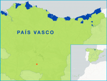
    The FLAG area covers the municipalities of Castro Urdiales, Colindres, Laredo and Santoña, along the eastern coast of Cantabria. The county boasts a rich landscape of wetlands with canals, river deltas and muddy plains, including the Santoña Natural Park.
  • Eastern Asturias FLAG

    12/09/2017
    - FLAG Factsheet
    The Eastern Asturias FLAG area consists of four municipalities: Caravia, Ribadesella, Llanes and Ribadedeva. Although located on the periphery of Asturias region, the area’s location does not present any infrastructural or service insufficiencies. The area has a strong tourism sector, which represents nearly 80% of its economic activity.
  • Basque FLAG

    12/09/2017
    - FLAG Factsheet
    The autonomous community of the Basque Country, situated at the easternmost end of the Cantabrian coast area, has 246km coastline, representing 5% of the Spanish coast.
  • Bajo Nalón FLAG

    12/09/2017
    - FLAG Factsheet
    The Bajo Nalón FLAG area is made up of just two municipalities (Muros de Nalón and Soto del Barco) in the Asturian region. This area also includes the Nalón river, the largest and most important river of the Spanish northern coast. Both municipalities are located at the mouth of the Nalón river.
  • La Sidra FLAG

    12/09/2017
    - FLAG Factsheet
    The Sidra FLAG, located in the mid-eastern part of Asturias, consists of five municipalities: Colunga, Bimenes, Cabranes, Nava and Villaviciosa. The area spans 570km2 which is approximately 5% of the Asturian region.
  • Olt FLAG

    12/09/2017
    - FLAG Factsheet
    The FLAG is located between the Danube and Olt rivers and benefits from various fishing and aquaculture resources that allow opportunities for activities such as tourism or sport fishing.
  • Holderness FLAG --ARCHIVED as of 31 January 2020--

    12/09/2017
    - FLAG Factsheet
    --ARCHIVED as of 31 January 2020-- The Holderness Coast fisheries is a small scale coastal fisheries area specialising in crab and lobster. It is a vibrant industry which continues to grow and develop in the context of a struggling coastal economy traditionally dependant on seaside tourism.