In the region of the Shabla - Kavarna - Balchik FLAG in Bulgaria, Roma and Muslims are important minority groups, making up 10% of the population. The Roma have faced a long history of national exclusion that has led to a series of national strategies for their integration.
The FLAG area covers the region of the northern part of the Amvrakikos gulf and the Ionian Sea in the Preveza prefecture. The area is well known for its environmental richness and hosts both a RAMSAR wetlands protection area and multiple Natura 2000 sites. Numerous avifauna, mammals, fish and vertebrate species are found here.
The FLAG area covers 262 203 square kilometres and 3.55% of its population is employed in fisheries or aquaculture. In the region, maricultural activities are extensive and intensive. This includes the farming of seafood species such as bream and sea bass.
The Soča Valley FLAG is in north-western Slovenia near the border with Italy. It includes the river Soča which has its source in the Julian Alps, and which attracts fishermen and visitors from all over the world each year. The most important sector in the FLAG area is processing which represents 30% of total employment.
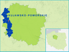
The FLAG is located in the western part of the Kujawsko-Pomorskie voivodeship, an area rich in rivers and lakes (including the Noteć river and the Bydgoszcz Canal). The fisheries activity is carried out by a few large aquaculture producers (mainly carp) and by the Polish Anglers’ Association who owns 5750 ha of waters.
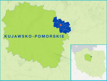
The FLAG area is a mostly rural area located in the north-eastern part of Kujawsko-Pomorskie region, along the valley of the Drwęca river. There is a long tradition of lake fishing.
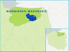
The FLAG is located in the Masurian Lakes region in north-eastern Poland. This area has a very high number of lakes – over 300, with a total surface of over 27 000 hectares, including the largest Polish lake, Śniardwy.
The FLAG is located in the inland part of the Pomeranian region and includes many lakes and rivers as well as fish farms. The rivers of the area are home to many valuable species of salmonid fish and, as such, offer excellent angling opportunities.
The FLAG is located on the Baltic sea coast north of the city of Gdańsk. The area has valuable natural assets, many of them protected. The main economic activities are tourism, fishing and fish processing.