FARNET
Fisheries Areas Network

Climate change

  • South Ipeiros Amvrakikoy FLAG

    02/06/2017
    - FLAG Factsheet
    The FLAG area covers the region of the northern part of the Amvrakikos gulf and the Ionian Sea in the Preveza prefecture. The area is well known for its environmental richness and hosts both a RAMSAR wetlands protection area and multiple Natura 2000 sites. Numerous avifauna, mammals, fish and vertebrate species are found here.
  • Bytow Lake District FLAG

    31/05/2017
    - FLAG Factsheet
    The FLAG is located in the inland part of the Pomeranian region and includes many lakes and rivers as well as fish farms. The rivers of the area are home to many valuable species of salmonid fish and, as such, offer excellent angling opportunities.
  • North Kaszuby FLAG

    30/05/2017
    - FLAG Factsheet
    The FLAG is located on the Baltic sea coast north of the city of Gdańsk. The area has valuable natural assets, many of them protected. The main economic activities are tourism, fishing and fish processing.
  • Talsi FLAG

    30/05/2017
    - FLAG Factsheet
    The Talsi FLAG is located in North Kurzeme, with a 54 km coastline along the Gulf of Riga. The FLAG area has a long history and tradition in fisheries. The activities of businesses are closely linked to the use of local natural resources
  • Venetian - VeGAL FLAG

    16/05/2017
    - FLAG Factsheet
    The territory of VEGAC covers the entire coast between the mouth of the river Tagliamento (North) and the northern pier of the Port of Chioggia (South). Economically, the area developed since the seventies into a major seaside resort system characterized by tourist flows thanks to the large sandy shoreline north of the Venice lagoon and to the proximity to the historic city of Venice.
  • Northern Artabro Gulf FLAG

    18/04/2017
    - FLAG Factsheet
    The Golfo Ártabro Norte FLAG is situated in the northeast of Galicia. It includes ten municipalities located north of the (“Golfo”) Ártabro Bay, more specifically those around the rias of Betanzos, Ares and Ferrol. The territory has 10 landing points with basic facilities used daily by around 250 small-scale traditional fishing boats. In addition, shell fish gatherers are working in the tidal area of the beaches.
  • Lemesos FLAG

    10/04/2017
    - FLAG Factsheet
    The Lemesos FLAG is found in southern Cyprus and bordered by the district of Paphos and Larnaca. The FLAG area covers ten communities within the Limassol district and Municipality. Within the locality, the area of Amathus, in the Agios Tychonas community, is designated as a marine protected area for historical reasons.
  • Vigo – A Guarda FLAG

    28/12/2016
    - FLAG Factsheet
    The FLAG area covers 11 municipalities in the south of Galicia and is bordered by Portugal to the south. It includes Vigo, the biggest city in Galicia and the largest fishing harbor in Spain. There are 12 other ports in the area mainly in the north (with 10 auctions and 4 marinas). In the north, fishing is an important activity, whereas to the south, shellfish activities, processing and canning.
  • Liepaja FLAG

    26/12/2016
    - FLAG Factsheet
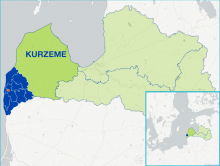
    The Liepaja FLAG area is located in the south-western part of Latvia, bordering with Lithuania. The FLAG area stretches for 111.28 km along the Baltic coast and includes the municipalities of Ventspils, Saldus and Kuldiga districts. Five percent of the area is covered by waterways, which include the rivers Bārta and Durbe, and the Liepāja, Pape, Tosmare and Durbe lakes. Forestry accounts for a further 41% of the FLAG area.
  • Finnish FLAG open to cooperation for inland fisheries projects

    21/11/2016
    - Cooperation Idea
    The Bothhian Sea and Lake Pyhäjärvi FLAG from the south of Finland is open to cooperation ideas. The FLAG has long-term experience in lake fisheries and in the development of fisheries with a strong link to water quality management.