The coastal area of the Mediterranean Pyrenees is defined by the presence of and connections between the land and sea, resulting in a remarkable geological, environmental and economic landscape. The area boasts strong tourist attractiveness, cultural and gastronomical traditions, and unique environmental assets which are monitored closely by local and national scientific research institutions.
Maritime activities (fishing, aquaculture, harbour and nautical activities) are at the heart of the economy of the FLAG area which also includes renewable marine energies, coastal agriculture (mainly vegetables), and strong tourism activities based on remarkable landscapes. The territory features a very active cultural life.
The fisheries, aquaculture and harvesting activities in the area allow a varied product offer: mussels, shellfish, fish and marine plants. This rich area, both ecologically and culturally, must manage its resources in a sustainable way.
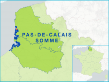
The Opale Coast FLAG area has 76 500 inhabitants and covers the ‘Communauté d'agglomération du Boulonnais,’ an intercommunal centred on the city of Boulogne-sur-Mer, the largest fishing port in France which lands over 35 000 tonnes annually.
The FLAG is located in the southeast of Galati county. Apart from the Danube, the FLAG area also includes two main rivers, the Prut and the Siret, lakes and ponds. Fishing here is mainly small-scale and inland.
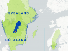
The FLAG area covers the whole lake Vättern, which is the second largest lake in Sweden. There are around 20 commercial small-scale fishermen and the species of greatest economic value is crayfish.
The area stretches over a cluster of some 30,000 sparsely populated islands and a small portion of the mainland’s countryside. It forms part of the commuter belt of Sweden’s capital city with the resulting high property prices, frequent ferry crossings and other commuter traffic that this can bring.
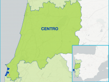
The FLAG area extends over a coastal area of 35km and covers five parishes in two municipalities. This territory is noted for its traditional small-scale fisheries. This is a predominantly agricultural area with a growing tourist sector thanks to its accessible beaches.
The Saaremaa FLAG covers the islands of western Estonia in Saare county, with exception of Hiiumaa which has its own FLAG. The biggest islands in the Saaremaa FLAG area are Saaremaa, Muhu, Ruhnu, and Abruka ja Vilsandihe.
The area includes the coast of the Ilia prefecture and the Pinios Lake and is located along the western half of the Peloponnese peninsula. The fisheries activities found here are mostly small-scale.