FARNET
Fisheries Areas Network

Fisheries resources

  • Northern Ireland FLAG --ARCHIVED as of 31 January 2020--

    10/04/2019
    - FLAG Factsheet
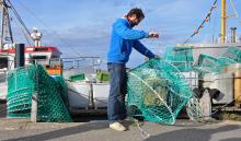
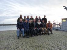
    --ARCHIVED as of 31 January 2020-- The FLAG is located along the South Eastern shores of County Down. The three main villages include in the territory are Ardglass, Kilkeel and Portavogie. The historic coastal ports of these three which comprises 95% of the fisheries industry in Northern Ireland. All are historic coastal ports, with many families working in the fishing industry for generations.
  • Women in fisheries

    10/04/2019
    - Cooperation Idea
    In the context of the Blue Growth and the local development of the Chioggia and Delta Po area, Chioggia and Delta Po GAC FLAG intends to propose a European Cooperation Project focused on “Women in Fisheries”.
  • Credit Unions

    08/04/2019
    - Good Practice Project
    Η τοπική ομάδα FLAG της Κορνουάλης και των Νησιών Σίλι έχει εκπονήσει ένα σχέδιο Πιστωτικής Ένωσης, το οποίο αποσκοπεί στο να συνδράμει εκείνους που δεν μπορούν να έχουν πρόσβαση σε χρηματοδότηση μέσω επιχορηγήσεων χωρίς αρχική στήριξη.
  • Cuan Beo project in Connaught, Ireland

    Cuan Beo, a living bay in West Ireland

    08/03/2019
    - Good Practice Project
    Το Cuan Beo δημιουργήθηκε από μέλη της κοινότητας που ζουν και εργάζονται κοντά στον κόλπο Galway και είχαν επίγνωση της γενικής υποβάθμισης της ποιότητας των υδάτων του κόλπου όπου παράγονται τα φημισμένα οστρακόδερμα.
  • Bulgarian Black Sea Agreement Byala-Dolni chiflik-Avren

    23/01/2019
    - FLAG Factsheet
    The FLAG territory includes 45km of the Black Sea coast in Varna Province, equating to approximately 13% of the Bulgarian Black Sea coastline. The leading industries in the area are tourism and agriculture. Fisheries in the region are small-scale and important in the local population – roughly 5% of the economically active population are engaged in fisheries.
  • Fish traps - an alternative to gillnet-fishing in German Baltic Sea waters?

    14/12/2018
    - Good Practice Short Story
    By engaging local fishermen in the development and testing of environmentally-friendly fish traps, the Baltic Sea FLAG is paving the way for sustainable fisheries along its coast in a wider context of adding value to the local catch.
  • Co-management of fish resources in Lake Vãttern

    29/08/2018
    - Good Practice Project
    The Lake Vãttern Co-management Group, supported by the FLAG, is helping local stakeholders to reach a consensus on the sustainable management of fish resources of the second largest lake in Sweden.
  • Enhancing native oyster stocks in Tralee Bay

    24/08/2018
    - Good Practice Project
    Ένας αλιευτικός συνεταιρισμός υιοθετεί τη νέα τεχνολογία για να διασφαλίσει τη βιωσιμότητα των αποθεμάτων αυτοχθόνων στρειδιών της περιοχής. Με τη βοήθεια των συλλογέων γόνων στρειδιών («coupelles») που χρησιμοποιούνται στη Γαλλία, η Εταιρεία Αλιέων Στρειδιών του Tralee κατάφερε να εξασφαλίσει ένα καλύτερο μέλλον για τους αλιείς στρειδιών της, όπως και για την τοπική παράδοση που αντιπροσωπεύουν.
  • Šiauliai Region FLAG

    31/07/2018
    - FLAG Factsheet
    The Šiauliai FLAG area has a high potential for the development of tourism and recreational activities. Situated in the North of Lithuania, it has a rich cultural heritage and numerous natural monuments. The region has a wealth of inland waterways and ponds which are ideal for the creation and development of fisheries and aquaculture, recreational fishing activities and water sports.
  • Neringa FLAG

    31/07/2018
    - FLAG Factsheet
    The Neringa FLAG area is located between the Baltic Sea and the Curonian Lagoon. The city of Neringa was formed in 1961 and comprises a territory of eight separately administered areas, of which the central area is Nida. The city is situated in the Curonian Spit National Park and shares both a land and water border with the Russian exclave of Kaliningrad.