This guide provides tools for FLAGs to identify and effectively address social exclusion in fisheries areas. It is made up of two parts, each consisting of practical factsheets, and most of the examples and recommendations are based on the FARNET transnational seminar on social inclusion, covering themes such as the inclusion of vulnerable groups and integrating migrants and refugees in fisheries communities.
The FLAG is situated in the south of the Tuscany Region on the Mediterranean Sea (Mar Tirreno). This region has a long fisheries tradition, nevertheless, the fisheries communities’ population and fleet have been reduced by 50% over the last 30 years.
The FLAG area covers the 342km coastline of Tenerife which varies from rocky cliffs to low coastline and beaches. Tenerife is very much geared around tourism but there are many activities that utilise the island’s coast and marine space. Employment levels are good in the coastal area and fishing and aquaculture account for 3.4% of the island’s total employment and around 2% of its GDP
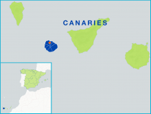
La Palma is one of the Canary Islands located in the Atlantic Sea. The FLAG consists of 14 municipalities, covers an area of approximately 710km2, and has a population of roughly 80 000 inhabitants.
The FLAG covers the municipalities of Hermigua, Vallehermoso, Valle Gran Rey, San Sebastián, Agulo, and Alajeró, covers an area of approximately 370km2 and has a population of 21 000.
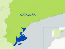
The Ebro FLAG operates on the Mediterranean coast, in the south of Catalonia. It borders with Aragon to the West and the region of Valencia to the south. The municipalities covered are located along the final stretch of the Ebro river, in the unique setting of the Ebro Delta. The most important port in the area is Sant Carlos de la Ràpita.
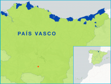
The autonomous community of the Basque Country, situated at the easternmost end of the Cantabrian coast area, has 246km coastline, representing 5% of the Spanish coast.
--ARCHIVED as of 31 January 2020-- Cornwall and the Isles of Scilly lie at the very south-western tip of Britain and are home to some of the most unique coastal features in the United Kingdom. The fisheries sector here is very diverse and versatile in terms of methods and target species.
The FLAG area is situated in the southeast of Sweden and features numerous lakes, streams, coasts and seas, forming a unique development area.
Challenges for the area include the low added value of local fisheries products.
One of the main needs identified by the Galati FLAG in their fisheries area was to strengthen the linkages between fishermen and the younger generation. Indeed, fishermen believed it important to ensure that traditional fishing know-how and their passion for the profession were passed on to the next generation.