FARNET
Fisheries Areas Network

Traceability

  • Dumfries & Galloway FLAG --ARCHIVED as of 31 January 2020--

    28/12/2016
    - FLAG Factsheet
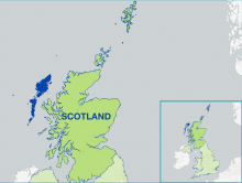
    --ARCHIVED as of 31 January 2020-- The FLAG area is distinguished by its intrinsic remoteness and natural beauty, illustrated by the high number of wildlife and landscape designations along the coast. The FLAG covers approximately 290 miles (467km) of coastline from Cairnryan in the East to Gretna in the West and includes the port at Kirkcudbright is which is in the top 20 UK ports by catch value.
  • Outer Hebrides FLAG --ARCHIVED as of 31 January 2020--

    28/12/2016
    - FLAG Factsheet
    --ARCHIVED as of 31 January 2020-- The Outer Hebrides is a chain of more than 100 islands and skerries located about 70 kilometres north west of mainland Scotland, of which 15 are inhabited. The Outer Hebrides Fisheries Area is defined using the Comhairle nan Eilean Siar Local Authority area which is has the same boundaries as many other organisations including the Outer Hebrides Inshore Fisheries Group.
  • Certified octopus fishery

    16/09/2016
    - Good Practice Project
    With the support of Axis 4, a Spanish octopus fishery became the world’s first to receive Marine Stewardship Council (MSC) certification, opening up new marketing opportunities to the local fleet.
  • FiskOnline - The pathway to eco-certification

    14/01/2016
    - Good Practice Short Story
    FiskOnline has established a pathway for local fishermen to gain certification for the sustainability for their fishing activities.
  • Good Practice - Archive 2007-2013

    01/07/2015
    - Basic page
    This page leads to all the project examples published during the 2007-2013 programming period.