FARNET
Fisheries Areas Network

Processing

  • Seaweed business knowledge & skills for local seafood price improvement

    16/05/2018
    - Cooperation Idea
    The Djursland FLAG is looking to learn from other FLAG areas in order to develop projects to improve the sales price of local seafood, ideally in contexts similar with its fisheries communities (small-scale, Baltic/North Sea coastal fisheries).
  • Highland & Moray FLAG --ARCHIVED as of 31 January 2020--

    12/02/2018
    - FLAG Factsheet
    --ARCHIVED as of 31 January 2020-- Previously operating as two separate FLAGs, Highland and Moray have formed a regional partnership to deliver the 2014-2020 programme. The Highland & Moray FLAG is the largest UK FLAG in operation covering 4,985km of coastline around some of the most sparsely populated and remote land in Europe.
  • Calarasi Danube FLAG

    16/01/2018
    - FLAG Factsheet
    The FLAG territory is flat, located in the South-East of the country and consists of the Bărăgan plain and the Danube meadow. In the FLAG area, there are natural coastline wetlands with great biological diversity.
  • Bisset’s Fish Van

    11/01/2018
    - Good Practice Project
    Familienbetrieb erwirbt mit finanzieller Förderung der FLAG einen Verkaufswagen für die Haustürlieferung von Frischfisch
  • North of Tyne FLAG --ARCHIVED as of 31 January 2020--

    15/12/2017
    - FLAG Factsheet
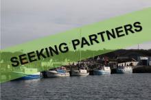
    --ARCHIVED as of 31 January 2020-- The area comprises 14 settlements with fishing activity from North Shields in the south to Berwick-upon-Tweed in the north, covering a distance of approximately 105 km, with a coastal population of 72,728, and with over 150 people directly in the fishing industry.
  • Forth FLAG --ARCHIVED as of 31 January 2020--

    15/12/2017
    - FLAG Factsheet
    --ARCHIVED as of 31 January 2020-- The FLAG area covers the fisheries communities and coastline of the three combined local authority areas of Scottish Borders, East Lothian and Fife. The area includes 12 working harbours, several of which are discrete fishery harbours built in the 19th century.
  • EE208 Lake Peipsi FLAG

    Lake Peipsi FLAG

    04/12/2017
    - FLAG Factsheet
    Lake Peipsi is the fourth largest lake in Europe and Estonia's largest FLAG. The Peipsi fisheries areas include Lake Peipsi, Lake Pihkva, Lake Lämmijärv, nine lakes in Vooremaa and the coastal areas of Suur-Emajõgi downstream from the city of Tartu.
  • ADREPES Costeiro FLAG

    09/11/2017
    - FLAG Factsheet
    The peninsula of Setúbal is located in the south of Lisbon and has many urban and suburban centres. Here, fishing is an important activity that has developed over centuries along the Atlantic coast and the estuaries of Sado and Tejo.
  • Samos FLAG

    31/10/2017
    - FLAG Factsheet
    The FLAG territory is made up of a series of small-scale fishing, environmental and touristic areas. The entire area has a long, mostly coastal fishing tradition, which is an integral part of the local culture of these island communities.
  • Pillio FLAG

    30/10/2017
    - FLAG Factsheet
    The FLAG area consists of the Sporades islands, and the community of Trikeri. The morphology, the limited degree of human intervention and the excellent condition of the natural environment, makes the area an ideal refuge for many endangered species.