FARNET
Fisheries Areas Network

Labelling

  • Halkidiki FLAG

    26/05/2017
    - FLAG Factsheet
    The FLAG area is situated along the border between the two municipalities of Halkidiki (Sithonias and Aristoteles). Its rural and mountainous geographic characteristics determine its economy and productive profile and have driven growth in the primary sector.
  • LLSÆ FLAG

    08/05/2017
    - FLAG Factsheet
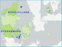
    The FLAG area covers three islands: Langeland, Læsø and Ærø – which gives a long coastline, made up of sandy beaches, like much of the Danish coastline. Tourism is the area’s dominant sector. and there are eight operational fishing ports on the three islands.
  • Oscos-Eo FLAG

    18/04/2017
    - FLAG Factsheet
    The local fishing sector is made up of small-scale inshore operations and shellfish gathering. The only oyster farms in Asturias are also located in this territory. Other relevant economic activities carried out in the FLAG´s territory are agriculture and rural tourism.
  • Costa Sostible FLAG

    29/03/2017
    - FLAG Factsheet
    The FLAG territory covers both the Ria de Muros e Noia and the Ria de Corcubión. The region has historically been highly dependent on fishing even though the sector has not reached the same importance as it has in the south of Galicia.
  • GPS012-goosebarnacle

    Innovation in goose barnacle traceability

    29/12/2016
    - Good Practice Short Story
    The harvesting of goose barnacles (Pollicipes pollicipes) is an important economic activity in the Berlengas archipelago, located north of Lisbon around the Peniche peninsula.
  • Wagrien-Fehmarn FLAG

    28/12/2016
    - FLAG Factsheet
    The FLAG is located on the Baltic coast of Schleswig-Holstein. It covers the eastern part of the Wagrien peninsula and Fehmarn, the third biggest island in Germany. Fehmarn is linked to the mainland by the Fehmarnsund bridge and has the most used ferry connection for both the Germans and Danes to the nearby port of Rødby on the island of Falster in Denmark, lying on the Hamburg-Copenhagen axis.
  • Dumfries & Galloway FLAG --ARCHIVED as of 31 January 2020--

    28/12/2016
    - FLAG Factsheet
    --ARCHIVED as of 31 January 2020-- The FLAG area is distinguished by its intrinsic remoteness and natural beauty, illustrated by the high number of wildlife and landscape designations along the coast. The FLAG covers approximately 290 miles (467km) of coastline from Cairnryan in the East to Gretna in the West and includes the port at Kirkcudbright is which is in the top 20 UK ports by catch value.
  • anaptiksiaki-kavalas-logo

    Processing and retailing fisheries and aquaculture products

    21/11/2016
    - Cooperation Idea
    The KAVALA FLAG from Greece aims to encourage private investment in processing fisheries and aquaculture products (FAPs), highlighting the new opportunities and markets.
  • Certified octopus fishery

    16/09/2016
    - Good Practice Project
    With the support of Axis 4, a Spanish octopus fishery became the world’s first to receive Marine Stewardship Council (MSC) certification, opening up new marketing opportunities to the local fleet.
  • FiskOnline - The pathway to eco-certification

    14/01/2016
    - Good Practice Short Story
    FiskOnline has established a pathway for local fishermen to gain certification for the sustainability for their fishing activities.