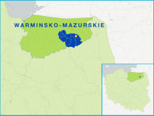
The FLAG is located in the Masurian Lakes region in north-eastern Poland. This area has a very high number of lakes – over 300, with a total surface of over 27 000 hectares, including the largest Polish lake, Śniardwy.
The FLAG is located in the inland part of the Pomeranian region and includes many lakes and rivers as well as fish farms. The rivers of the area are home to many valuable species of salmonid fish and, as such, offer excellent angling opportunities.
The FLAG is located on the Baltic sea coast north of the city of Gdańsk. The area has valuable natural assets, many of them protected. The main economic activities are tourism, fishing and fish processing.
The FLAG is located in Western Pomerania close to the cities of Szczecin and Stargard as well as to the German border. Agriculture dominates the area, but there is also fish farming and lake fishing.
The FLAG is located in the provinces of Nuoro, Ogliastra and Cagliari, covering the north of Baronia, the centre of Ogliastra, Sarrabus and the south of Cagliari. The FLAG has an important fisheries and aquaculture sector, accounting for 3.5% of the total number of active enterprises in the area.
The FLAG area of Pieria, which is found along the western shore of the Gulf of Thermaikos, is a rural area where fishing is an important economic activity. It is well known for shellfish farming and in 2014 it produced over 8 400 tons of mussels representing over 85% of overall Greek production for the year. In addition to aquaculture, sea fishing remains important here.
The FLAG area stretches between two gulfs on the Macedonian coast. Its main advantage is its proximity to the big market town of Thessaloniki. The type of fisheries found here ranges from small to medium scale. The area has one fishery harbour with a fish auction, three fishery shelters, and significant processing infrastructure.
The FLAG area is situated along the border between the two municipalities of Halkidiki (Sithonias and Aristoteles). Its rural and mountainous geographic characteristics determine its economy and productive profile and have driven growth in the primary sector.
The area is very rural with thousands of years of history. There are many protected sites of natural beauty and the region attracts many tourists especially to the well-known island of Thassos. Fisheries in this area is mostly small-scale, complemented by some aquaculture and a limited amount large-scale fisheries activities.
The FLAG area comprises the lagoons of Vistonida, Ismarida, Porto Lagos, Aliki, Ptelea, Xirolimni and Karatza, parts of the Nestos and Kompsatos river basins and the coastline of Rodopi and Xanthi prefectures (up to 10 km inland).