FARNET
Fisheries Areas Network

Governance

  • Giurgiu FLAG

    11/06/2019
    - FLAG Factsheet
    The FLAG is situated in the southern and central part of the Romanian Plain. The landscape is flat, crossed by many small rivers. To the north are the Argeş and Dâmboviţa Rivers. To the south, the area covers 55km of the Danube River which also marks the Bulgarian border.
  • Mures Basin FLAG

    11/06/2019
    - FLAG Factsheet
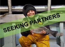
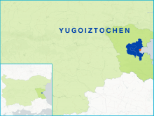
    The FLAG territory is specifically focused on aquaculture and partially includes the areas of two counties, Alba and Hunedoara, which are situated along the Mureș river basin. Economic activities in the region are spread among the construction, commerce and services, agriculture and fisheries, and tourism sectors.
  • Cooperating to preserve protected species and fishing businesses

    11/04/2019
    - Good Practice Short Story
    ‘Tarta-Tur’, a combination of the Italian word for turtle (Tartaruga) and dolphin in Latin (Tursiops), is a conservation project involving four FLAGs across three Italian regions on the Northern Adriatic Coast.
  • Northern Ireland FLAG --ARCHIVED as of 31 January 2020--

    10/04/2019
    - FLAG Factsheet
    --ARCHIVED as of 31 January 2020-- The FLAG is located along the South Eastern shores of County Down. The three main villages include in the territory are Ardglass, Kilkeel and Portavogie. The historic coastal ports of these three which comprises 95% of the fisheries industry in Northern Ireland. All are historic coastal ports, with many families working in the fishing industry for generations.
  • Cleddau to Coast FLAG --ARCHIVED as of 31 January 2020--

    10/04/2019
    - FLAG Factsheet
    --ARCHIVED as of 31 January 2020-- Pembrokeshire has a long tradition of fishing, both sea and freshwater. Tenby was the prime fishing port of the area for many centuries. More recently Milford Haven has developed and taken more of a predominant role in the area’s fishing industry; this was also due in large to Tenby becoming more of a holiday resort.
  • Cardigan Bay FLAG --ARCHIVED as of 31 January 2020--

    10/04/2019
    - FLAG Factsheet
    --ARCHIVED as of 31 January 2020-- The FLAG area is situated around the Cardigan Bay which leads out into the Irish Sea. It provides rich fishing grounds for the small commercial fishing fleets which operate from some of the small villages and towns within the area.
  • "Coastal Agreement" for smart coastal areas

    10/04/2019
    - Cooperation Idea
    The Chioggia and the Delta Po GAC FLAG proposes launching an inter-territorial and transnational cooperation project called "Coastal Agreement for SMART Coastal Areas".
  • Argyll and Ayrshire FLAG --ARCHIVED as of 31 January 2020--

    10/04/2019
    - FLAG Factsheet
    --ARCHIVED as of 31 January 2020-- The main population centres are primarily located towards the coastal fringes in the larger towns of Ayr, Troon and Girvan, with fishing an important industry in these towns. There are many coastal communities in North Ayrshire, some of which are viewed as relatively affluent areas and locations for retirement. The economy is largely based on tourism, including sailing.
  • Women in fisheries

    10/04/2019
    - Cooperation Idea
    In the context of the Blue Growth and the local development of the Chioggia and Delta Po area, Chioggia and Delta Po GAC FLAG intends to propose a European Cooperation Project focused on “Women in Fisheries”.
  • Burgas-Kameno FLAG

    09/04/2019
    - FLAG Factsheet
    The FLAG is situated in the Burgas region and covers part of the Burgas Bay and its adjacent inland zones. The FLAG territory also includes the municipality of Kameno, which is a rural area. In total, there are 27 water basins on the FLAG territory. The fisheries industry is represented by six aquaculture farms and eight processing companies.