FARNET
Fisheries Areas Network

Diversification

  • Bay of Anllons pool heated by water from solar panels

    Circular thinking to promote local shell-fishing

    11/02/2019
    - Good Practice Project
    To promote the local shellfish activity and its products, a FLAG redevelops an area overlooking the bay where its cockle pickers work and installs a shallow outdoor pool for kids, heated with excess hot water from the nearby leisure centre.
  • Pomorie FLAG

    23/01/2019
    - FLAG Factsheet
    The FLAG territory is in the south-east planning region of Bulgaria. The region has a strong fisheries tradition, though fisheries jobs only account for approximately 1% of the area’s total employment. However, many local fishers also engage in other occupations and activities such as tourism and services.
  • Bulgarian Black Sea Agreement Byala-Dolni chiflik-Avren

    23/01/2019
    - FLAG Factsheet
    The FLAG territory includes 45km of the Black Sea coast in Varna Province, equating to approximately 13% of the Bulgarian Black Sea coastline. The leading industries in the area are tourism and agriculture. Fisheries in the region are small-scale and important in the local population – roughly 5% of the economically active population are engaged in fisheries.
  • Shabla - Kavarna - Balchik FLAG

    23/01/2019
    - FLAG Factsheet
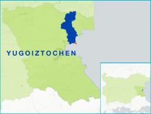
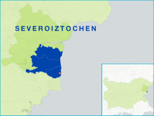
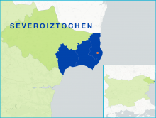
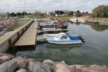
    The FLAG territory has two geographically distinct areas, the coastal region to the east and the Dobrudzha plateau to the west. Fishing in the coastal areas, on the Black Sea, is traditional activity and important to the livelihood of many local communities. Fisheries are predominantly small-scale, accounting for approximately 90% of the sectors total employment.
  • ee-eu-map-estonia-

    EE - FLAG Cooperation in Estonia

    15/01/2019
    - Cooperation MS Fiche
    Cooperation in Estonia will focus on three main areas: joint marketing, knowledge transfer and promotion of fisheries and maritime activities.
  • FLAG builds bridges between local fishermen and municipality to regenerate port of Puise

    12/12/2018
    - Good Practice Project
    Puise has become a thriving coastal fishing port in Läänemaa after a regeneration project supported by the local FLAG.
  • Prahova FLAG

    09/11/2018
    - FLAG Factsheet
    The FLAG covers an area of 1 833km2, accounting for just over a third of Prahova county. The region covers the southern slopes of the Southern Carpathians and descends south through the sub-Carpathian hills.
  • Fagaras FLAG

    09/11/2018
    - FLAG Factsheet
    The FLAG territory comprises the habitable area of the northernmost part of the Făgăraș Mountains, in the county of Brasov. The area is situated in the geographical centre of Romania and the Olt river runs through the FLAG’s territory, one of the country’s most important rivers.
  • Dolj-Danube FLAG

    09/11/2018
    - FLAG Factsheet
    The FLAG is situated in the southern part of the Dolj county, on the Danube, and on the border with Bulgaria. Agriculture is the region’s primary sector as the land is naturally suited for growing cereals, vegetables and fruit.
  • Constanta Mangalia FLAG

    09/11/2018
    - FLAG Factsheet
    FLAG Mangalia Litoral is in the south-east of Romania. The territory borders Bulgaria to the south and the Black Sea to the east and is characterised by coastal cliffs, coastlines and low floodplains.