The Elbe-Roeder-Dreieck FLAG is situated east of the river Elbe on the border between Brandenburg and Saxony. It is a rural region with a few focal points of large industry including steel and chemical plants. The landscape is characterised by high-value vineyards along the Elbe river and pond landscapes in the Roeder riverside floodplain. This area has been used for pond farming for about 300 years. The ponds were designed for purely economic reasons and served exclusively for carp pond farming.
The FLAG area covers most of the North Sea coastal strip which belongs to Lower Saxony. It includes the counties of Cuxhaven, Wesermarsch, Friesland, Wittmund, Aurich and Leer.
In this 2017 edition: support to small scale coastal fisheries, the challenge of generational renewal, FLAGs, local innovation and risk taking, cooperation takes off in CLLD fisheries areas, reports from Spain, Sweden and Germany
The Tirschenreuth FLAG region may have a long history of small family-owned aquaculture ponds but aquaculture did not always have the standing it enjoys today. The thousand-year-old tradition was almost forgotten when the FLAG took action to restore its cultural significance in the area.
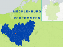
The FLAG area comprises a large part of the rural and sparsely populated Mecklenburg Lake District, which is characterised by vast interlinked inland waterways, many of which are protected areas.
The fishing activities in the Mecklenburg Lakes follow a longstanding tradition and play an important economic and historical role in the area.
Rügen is an island in the Baltic Sea and the largest in Germany. It is known for its beaches and white chalk cliffs which span coastline of approximately 574 kilometres. The island is also well-known for the Jasmund National Park which his home to primeval beech forests and white-tailed eagles.
Open natural areas, idyllic villages, extensive avenues, castles and manor houses dominate the landscape. The economy of this area traditionally consisted of agriculture, the food industry and tourism.
The FLAG area is located south of the coastal city of Rostock and the area of the Baltic Sea – Bad Doberan FLAG area in the German state of Mecklenburg-Vorpommern. It covers the territory of the Guestrow district and is an inland area. The main fishing activities in the region are small-scale inland pond fisheries.
The FLAG area is a coastal region situated near the city of Rostock in the north German state of Mecklenburg-Vorpommern and has a 62km coastline. In the west, the Wustrow peninsula rises into the Baltic Sea and surrounds the Salzhaff with the mainland. The Warnow river flows through the region and into the Baltic Sea at Rostock.