Fisheries activities have been long rooted in the FLAG area and, present in both its coastal waters and lagoons, are still closely associated with the local heritage. Indeed, it is the second French Mediterranean production area, hosting both fishing activities and shellfish farming.
The Morlaix FLAG comprises three communities, each with several municipalities. The capital city is Morlaix which has over 15 000 inhabitants. Agricultural is the area’s predominant industry and is made up of numerous small to medium size businesses. Fishing, a secondary sector in the area, mainly involves inshore fishing activities (75% of all local vessels)
Maritime activities (fishing, aquaculture, harbour and nautical activities) are at the heart of the economy of the FLAG area which also includes renewable marine energies, coastal agriculture (mainly vegetables), and strong tourism activities based on remarkable landscapes. The territory features a very active cultural life.
With its 460km of coastline, made up of harbours, bays, cliffs and long beaches, the West Normandy FLAG area has a wealth of coastal resources. It is an area with an important primary sector and a high production of fish and shellfish.
The Fecamp FLAG is situated in the east of Normandy and comprises a coastline of 30km, cliffs typical of the Albatre region and two neighbouring valleys of Valmont and Ganzeville which stretch 20km inland. The town of Fecamp was built in conjunction with the expansion and development of the areas sea fishing, processing and shipbuilding industries.
The fisheries, aquaculture and harvesting activities in the area allow a varied product offer: mussels, shellfish, fish and marine plants. This rich area, both ecologically and culturally, must manage its resources in a sustainable way.
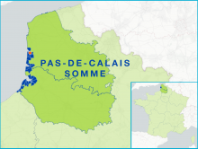
The Opale Coast FLAG area has 76 500 inhabitants and covers the ‘Communauté d'agglomération du Boulonnais,’ an intercommunal centred on the city of Boulogne-sur-Mer, the largest fishing port in France which lands over 35 000 tonnes annually.
The area has a strong historical, geographic and cultural identity, both rural and maritime. The Auray and Vannes area has been shaped by maritime activities for decades.
The FLAG area is situated on the Atlantic coast and has a strong maritime history and attractive environment. With cities such as La Rochelle and the island of Ré, the area is a stronghold for marine tourism, blue growth and maritime economy.
The territory covers the whole coastline of Corsica, which ranges from white sand beaches in the East to rocky coastline in the West. The local fisheries sector is made up exclusively of small-scale operators, with modest and declining production mostly organised around short-circuit sales, mainly to restaurants.