FARNET
Fisheries Areas Network

Croatia

  • Plodovi Mora FLAG

    01/08/2018
    - FLAG Factsheet
    The FLAG area mainly comprises the islands of the coast of Zadar where agriculture, aquaculture and fisheries were historically primary sectors.
  • Galeb FLAG

    14/06/2018
    - FLAG Factsheet
    The Galeb FLAG consists of six municipalities in the north-western part of Šibenik-Knin county which is situated in the central part of Croatia. The area’s landscape is characterised by limestone cliffs, numerous bays, and roughly 200 small islands.
  • Brac FLAG

    14/06/2018
    - FLAG Factsheet
    The FLAG area covers the island of Brač and its surrounding waters. Brač is an island in the Adriatic Sea, Croatia. With an area of 396km2, it the largest island in Dalmatia and the third largest in the Adriatic.
  • Lostura FLAG

    14/06/2018
    - FLAG Factsheet
    The FLAG area is situated in Zadar County and includes the territories of Pakoštane, Sv. Filip i Jakov, Tkon, Pašman and Biograd na Moru. The FLAG’s territory encompasses 46 islands in the Adriatic Sea, situated close to the mainland.
  • Tramuntana FLAG

    14/06/2018
    - FLAG Factsheet
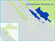
    The Tramuntana FLAG covers five local self-government units: Senj, Karlobag, Lopar, Rab and Novalja. The units are situated in the counties of Primorje-Gorski Kotar and Lika-Senj. Karlobag and Senj are coastal areas and the regions of Lopar, Novalja and Rab are located inland.
  • Vela Vrata FLAG

    14/06/2018
    - FLAG Factsheet
    The Vela Vrata brings together islands of Cres and Lošinj, and their respective towns and municipalities, and the city of Opatija, municipalities of Lovran and Mošćenička Draga on the coast.
  • Alba FLAG

    14/06/2018
    - FLAG Factsheet
    The Alba FLAG is situated in the region of Istria in the western part of Croatia and in the northeastern part of the Adriatic Sea. The area has a longstanding tradition of fisheries and aquaculture, industries which contribute significantly to the local economy. Other economic activities in the FLAG’s territory include tourism, construction and agriculture. The FLAG has many natural resources incl
  • Tunera FLAG

    14/06/2018
    - FLAG Factsheet
    The Tunera FLAG is situated in the Primorje-Gorski Kotar County and consists of coastal and mountain areas where there is a longstanding fishing tradition. There are 46 active fishing vessels in total, most of them under 12m in length.
  • Pinna Nobilis FLAG

    14/06/2018
    - FLAG Factsheet
    The FLAG area is situated in the north of Croatia near the border with Slovenia and close to Italy. The area’s key industries are tourism and other services, agriculture and fishing, focusing mainly on sardines and anchovy; there are also two aquaculture farms producing shellfish.
  • gac_logo

    New start-up company models for young unemployed people

    21/11/2016
    - Cooperation Idea
    The North Sardinia FLAG wishes to cooperate with FLAGs concerned with new start-up models led by young people, fishermen’s relatives or young people leaving secondary schools who want to create self-employment opportunities.